| Newsletter - 2009 Archive |
|
|

|
Cycling Club |
|
|
| Newsletter - 2009 Archive |
|
|
|
Cycling Club |
|
|
Next--->
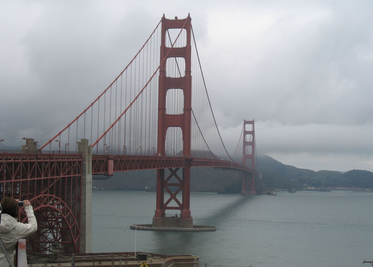 click to enlarge (photo: Melissa Friesen) Here is an offering from our Australian correspondent Scott Gater, who is now our California correspondent. [Eric F] SFR 200 With a starting location like the Golden Gate Bridge, it's no wonder 83 randonneurs showed up on a cool and grey morning on the first month of the year for the first brevet of the NorCal Randonneur season. The traditional start to the season, the route heads north into Marin county and then west to Point Reyes Lighthouse, then north to the village of Marshall before working its way back south to the Golden Gate bridge and the finish. Despite having lived in the Bay Area for almost a year, I had never ridden over the Golden Gate Bridge, so that was certainly part of the attraction to this ride. The chance to ride through the national parks of the North Bay area was also appealing. The ride started promptly at 7am. Riders flooded over the east side of the bridge and then worked their way through Sausalito and Fairfax through a network of bike trails and routes designed to keep us off the main roads until we reached Sir Francis Drake Blvd, the gateway to the rural parts of Marin county. As I had never ridden these roads before, the route sheet's network of left and right's in the early part of the ride suggested that teaming up with a "local" would be prudent. Fortunately with 83 riders, finding a group going the right way at the right pace did not take too long to do and our band of 12 made it through the 'maze' without a wrong turn through Fairfax and out towards the green spaces of Marin. Melissa and I had ridden part of Sir Francis Drake Blvd back in August; recalling the upcoming three km hill moderate climb, I went to the front at the base of the climb to get out of the claustrophobia I had in the group. As I got closer to the summit, other riders began to pass me, either suffering from the same group claustrophobia or taking my acceleration as some sort of challenge. Heading down the hill at the front of the group was a thrilling ride, with wide shoulders and a train of riders that regrouped on the descent. As we entered the first National park, the road quality got considerably worse so we used the bike path through the park. The RBA, Rob Hawks, in his pre-ride briefing permitted our use of the bike path because of the narrowness of the road through the park and its general state of decay. So off the road we went, and on to a wonderful ride through mossy green and shiny black roads, wet from the recent and well needed rain. Riding at the back gave me a chance to relax and take in the natural sights along the way. After 6km on the path, we rejoined Sir Francis Drake Blvd and rode on toward Point Reyes Lighthouse. A hill just prior to town broke up the group, so I rode by myself for the first time, slowly catching some riders ahead. We rode as a group on the rolling coastal terrain, but as is the frequently the case, as soon as the road slanted upwards, our group splintered and continued forward and upward at varied paces. Upon entering the national park another pre-ride reminder came to mind -- the fact that there were several working dairy farms along the road to the lighthouse. That meant dangerous cattle grates on the road (including one that was missing a couple of rungs) and the Belgian toothpaste of a farming area. Drafting was not recommended as so few riders had mudguards. The weather began to clear as I worked my way to the first control at the lighthouse. The wind was starting to pick up off the coast on my right and the sun was poking through the clouds to my left. In true Rando style, the control was at the top of a steep hill, a series of switchbacks on rough hewn roads. The control was a simple one at the lighthouse parking lot: a volunteer, a water jug, some energy bars and a couple toilets. A quick check in and I was back out on the road heading north again on the rolling hills alongside Tomales Bay, where the General store awaited in Marshall. The twists and turns of Hwy 1 kept the second control at Marshall hidden for a long while, so when the little blue building with bikes parked around it came into sight, it was most welcome. Inside the store, a choco chip cookie and some water was all I wanted. Many riders stood around eating the famous/fabulous clam chowder, something I wasn't keen to try at km 137 of a 200km ride. I made my turnaround quickly and headed south, seeing a steady stream of riders heading north to the control on this out-and-back stretch. At this point my cycle computer decided it didn't like my break and took one of its own. Having bought it recently, I hadn't memorized all the functions of it or exactly what all the buttons did and in what order they did those things. So I headed southward with two thoughts in my head: one, I had the route sheet in front of me and I could approximate distances, and two, I figured someone would pass me in the next 40 km and hopefully they would know where they were going let me tag along. I made it another hour or so south before
David Strong came up behind me just in time to alleviate my worry
of getting lost in Fairfax. I had ridden with David at GSR 1200
a few years back and had seen him at a Labor Day 200 north of
SF and knew that he is a pretty strong rider, so it was good
that he hung back to converse with me. We rode together through
Fairfax and Sausalito, until close to the Golden Gate Bridge
where David, riding his fixie, surged ahead on the final climb
of the ride. Finishing before 4pm was good for my morale, my
first 200 km event completed in eight months. It was good to
be back on the rando band wagon. Ride date:
January 24, 2009
February 17, 2009 |
_