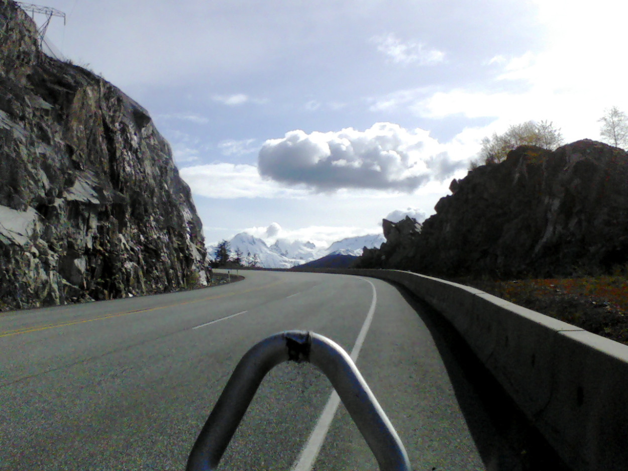
Photo from the volunteer pre-ride from Craig Premack
Pemberton 300
May 1, 6 a.m.
Deirdre Arscott & Bob LePage
Finish: North Vancouver: Boston Pizza, 1078 Marine Drive. 1.5 km from start.
|
Photo from the volunteer pre-ride from Craig Premack Pemberton 300 May 1, 6 a.m. Deirdre Arscott & Bob LePage Finish: North Vancouver: Boston Pizza, 1078 Marine Drive. 1.5 km from start. |
|
(cum.) |
|
|
|
G0 kms |
|
Harbourside Place & Fell Avenue |
||||
| 0.0 | N | Fell Ave | 0.4 | |
| 0.4 | L | W | 1st Street West | 1.0 |
| 1.4 | R | N | Pemberton Ave | 0.1 |
| 1.5 | L | W | Welch St | 2.0 |
| 3.5 | R | N | Bridge St | 0.5 |
| 4.0 | R | N | Taylor Way | 0.3 |
| 4.3 | CO | N |
"Continue past Marine Dr Option: Take Marine Dr. to Horsebay otherwise continue on Taylor Way." |
1.2 |
| 5.5 | L | W | HWY-1A [HWY-99], follow signs for HWY 99 to Squamish | 10.6 |
| 16.1 | BR | W | Exit 3. Follow Bike Route. | 0.6 |
| 16.7 | R | W | Bike Path. Follow narrow, steep path up to roundabout. Go around round about | 0.1 |
| 16.8 | R | W |
"Follow signs for Hwy 99 North. Caution: Shoulder narrows near Porteau Cove and after Brittania Beach." |
44.1 |
| 60.9 | R | E | Loggers Ln (Squamish) (Traffic Lights) | 2.8 |
| 63.7 | CO | NW | Loggers Ln (Go under Hwy) | 0.3 |
| 64.0 | R | N | Government Rd (do NOT go straight ahead) | 3.4 |
| 67.4 |
Bean Around the World on right in Eagle Run Mall (7:59 - 10:30) 84.9 km to next control |
0.0 | ||
| 67.4 | CO | N | Government Rd (Brackendale) | 1.1 |
| 68.5 | R | E | Depot Rd (caution on RRX) | 0.8 |
| 69.3 | L | N |
"HWY-99 [Sea To Sky Hwy] Caution: Watch for lumps of asphalt/sand" |
82.6 |
| 151.9 | L | NW | Pemberton Meadows Rd (Pemberton) | 0.5 |
| 152.4 |
Pony Restaurant on left (10:29 - 16:09) 30.5 km to next control |
|||
| UT | Return to N. Vancouver | 0.5 | ||
| 152.9 | R | S | HWY-99 [Sea To Sky Hwy] | 27.8 |
| 180.7 | R | W | Alpine Way (Whistler). Last place for water before Brackendale. | 0.1 |
| 180.8 | L | SE | Rainbow Dr/Alta Lake Rd (Whistler). 1st left. | 2.4 |
| 183.2 |
(Information Control) At Rainbow Trail Head, answer question on control card (11:23 - 18:11) 53.6 km to next control |
|||
| 183.2 | CO | SE | Alta Lake Rd (Whistler) | 6.9 |
| 190.1 | R | S | HWY-99 | 45.3 |
| 235.4 | R | W | Depot Rd (Squamish/Brackendale), careful on RRX | 0.8 |
| 236.2 | L | S | Government Rd | 0.3 |
| 236.5 | CO |
Brackendale General Store on right (13:01 - 21:46) 67.5 km to Finish |
0.0 | |
| 236.5 | CO | S | Government Rd | 4.1 |
| 240.6 | L | E | Loggers Ln (@SS. Unmarked. Sign says Government and Government.) Follow road under Hwy | 0.3 |
| 240.9 | CO | S | Loggers Ln | 2.8 |
| 243.7 | L | S |
"HWY-99 [Sea To Sky Hwy] Watch for sunken grates, debris and rumble strips on shoulder. " |
40.5 |
| 284.2 | BR | S | Exit "Hwy 99 South. Marine Dr via Horseshoe Bay". Follow Bike Route. | 2.8 |
| 287.0 | CO |
"Continue on highway Option: Take overpass to Marine Dr. to Taylor Way" |
11.9 | |
| 298.9 | BR | SE | Exit 13. Taylor Way | 0.4 |
| 299.3 | R | S | Taylor Way | 1.4 |
| 300.7 | L | E | Bridge St | 0.5 |
| 301.2 | L | E | Welch St | 2.0 |
| 303.2 | L | N | Pemberton Ave | 0.7 |
| 303.9 | R | E | Marine Dr | 0.2 |
| 304.1 |
Boston Pizza on left hand side 1078 Marine Drive (15:08 - 02:00) Congratulations! |
|||
|
|
||||
| Return to Start: | ||||
| 0.0 | CO | E | Marine Dr going East | 0.7 |
| 0.7 | R | S | Fell Ave | 0.8 |
| 1.5 | Harbourside and Fell | |||
| Note: This is not the official route sheet. Ride organizers may make last minute changes because of road closures or other problems. The route sheet you receive at the start of the ride is the official one. | ||||
|
BL=Bear Left BR=Bear Right ST=Straight CO=Continue T=U-Turn SS=Stop Sign RRX=Railroad Crossing - Alex Pope's Garmin Connect ride/route data - |
Notes from the pre-ride for spring LM300
The scenery is beautiful on this hilly (estimated 10,200 ft of climbing) route. Bring your climbing legs!
Some things to take note of:
- In West Vancouver, both outbound and inbound,
riders have the choice of riding the upper levels (Hwy 1/99) or
Marine Drive. The route instructions only give details for the
upper levels highway.
- For those of you who haven't been past Whistler, Pemberton is
1500 ft lower. So it's mostly downhill from Whistler to the turnaround
control in Pemberton but there are a few nasty little climbs in
there too. The control is at the Pony Restaurant, a nice place
for lunch. There is a bike shop in the same building as the restaurant.
- On the return leg, between Pemberton and Brackendale, there
is no food or water available except at the Alpine Way turnoff.
The route completely bypasses the main town of Whistler by taking
a quiet side road around Alta Lake.
Hwy 99, both directions
- Rumble strips come and go between Horseshoe and Squamish and
for a 20 km stretch south of Whistler. On the pre-ride, we found
it easy to cross the rumble strips.
- Between Brackendale and Whistler, there are lumps of asphalt/sand
on the shoulder at regular intervals
Hwy 99 Northbound
- Between Horseshoe Bay and Squamish, the shoulder narrows near
Porteau Cove and after Britannia Beach.
Southbound on Hwy 99
- Between Squamish and Horseshoe Bay, sunken grates, debris and
rumble strips on shoulder. Exercise extreme caution and go around
grates.
- Around Porteau Cove, there is no line to mark the shoulder and
the railway bed is immediately beside the road. There are also
pylons and other construction debris to avoid.
_