| Newsletter - 2013 Archive |
|
Cycling Club |
 |
| Newsletter - 2013 Archive |
|
Cycling Club |
|
Next--->
|
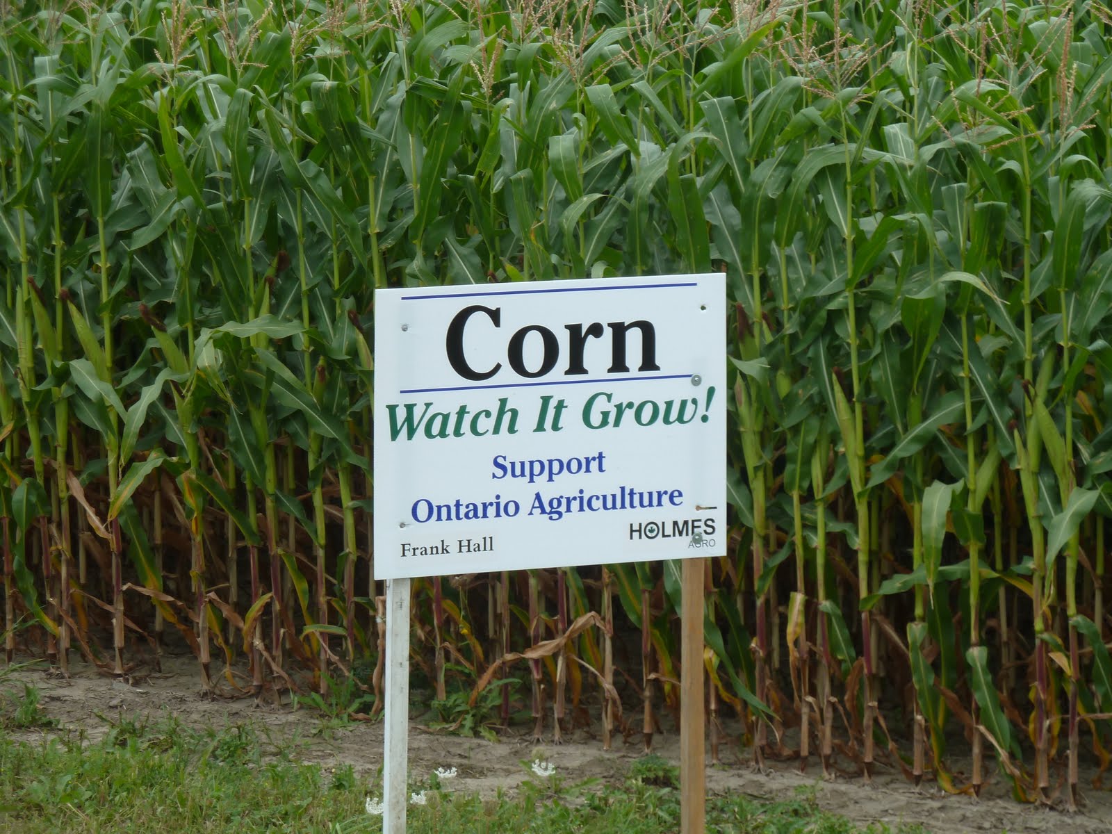
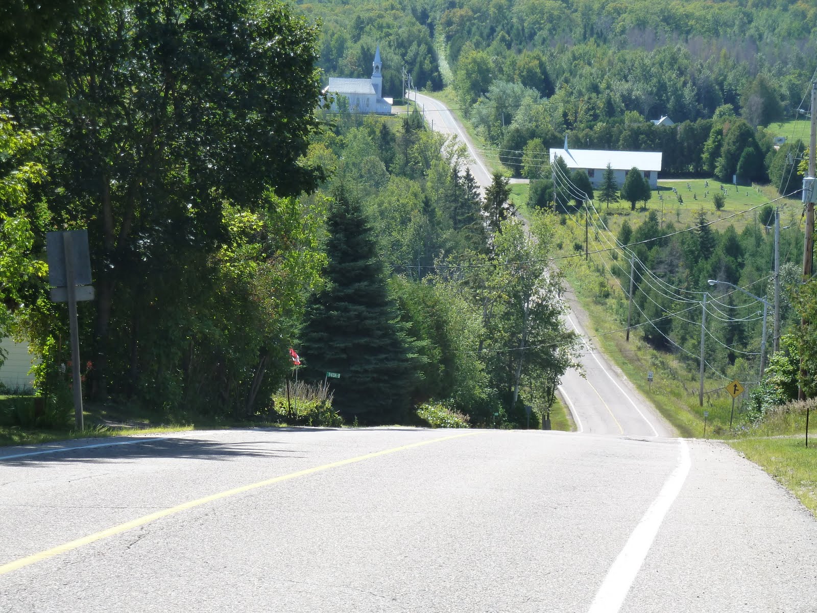
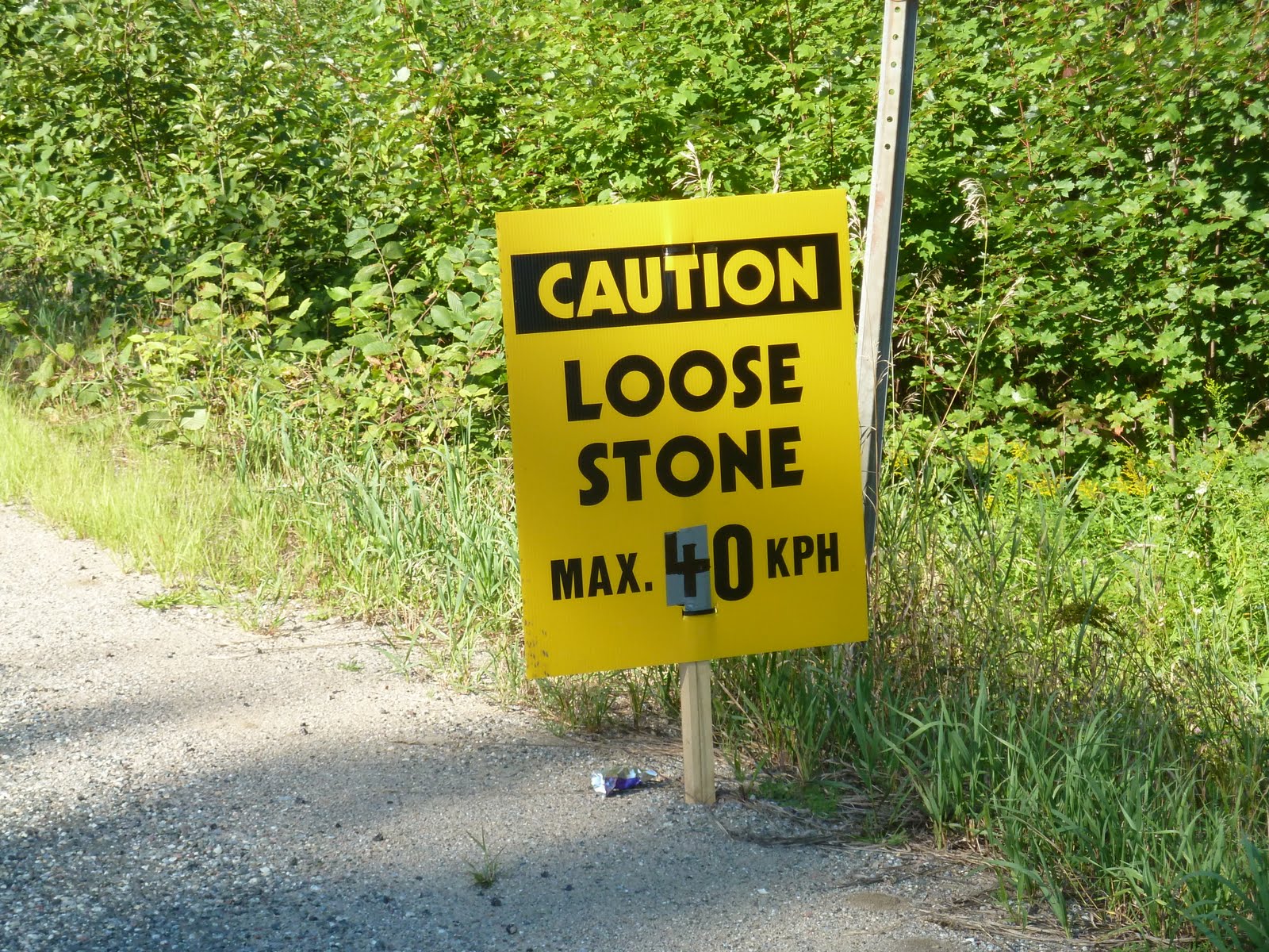
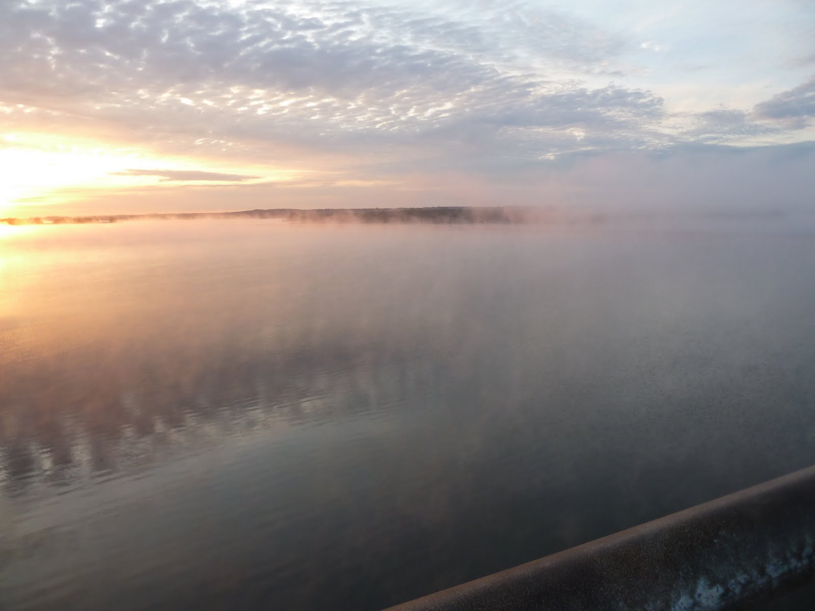
Granite Anvil 2013 Day 1 The Granite Anvil 1200 km brevet is all about exploring rural Ontario. It starts on the eastern outskirts of the big cities and manages to circle all the way around the Toronto area without ever getting into any densely populated areas. All of the first afternoon is spent riding through the farming country in the western part of southern Ontario. This area represents what I used to think most of Ontario looked like. Huge expanses of corn fields and not much else. Flat as a pancake. Except that the flatness is deceptive, it isn't really flat in the area that we rode through. There were lots of shallow rollers that gradually gained altitude. By my altimeter the high point of the ride was in a corn field north of Grand Valley. In the evening we did a long descent out of the corn into the Beaver Valley and then a long climb out of there and got a fine view of Georgian Bay before we descended past the Blue Mountain ski area. Then we went through Wasaga Beach and finished the day at Midland. The day started well enough for me. After the usual sprint start (that I no longer even bother to attempt to hang onto) I settled in with a group that was going at a brisk but manageable pace. I didn't know any of the riders in the group at this point. The organizers had us put frame plates I finally caught up with the group at the second control after chasing for 200 km through the brutal headwind. I had been quite worried before the ride that my fitness wasn't up to the task of a 1200 due to not enough riding in the previous months. My confidence improved a lot after my performance that afternoon. We all left the second control together and spent the rest of the evening riding through the ski area country and then through the resort beaches area and arrived at the overnight control in Midland at about 11:30 pm. This stage was 398 km and gained about 2800 meters of elevation. The control was in a motel. There was dinner and breakfast food laid out by the volunteers. Due to some scheduling quirk I ended up with a room with two queen beds all to myself and slept very well. Many randonneurs think that the success of an ultra brevet is measured by your finishing time. The fewer hours you spend out there, the better you are as a rider. Not me. I measure success by how many hours of sleep I get while still finishing within the 90 hour limit. This night I was able to get 3 1/2 hours of sleep. 4 1/2 would have been possible while still leaving an hour of margin before the control closed. But the organizers had recommended 2 hours of margin and the consensus of the group was to go with that. After chasing for most of the day on the first day I was quite happy to forgo the extra hour of sleep in order to have some companions for the next day. Day 2 We left Midland at 4:15 am and rolled along through the early morning to a staffed control at Big Chute. Hot coffee, hot soup, and hot chocolate got us moving along nicely through the awakening day to the next control at Houseys Rapids. Here there was a 'restaurant' serving breakfast. It was It got dark at about that point and so we rode on through Wilberforce (my favorite place name of the ride) and on into Bancroft under a nearly full moon. It was magic. We arrived at about 10:30 and had a nice meal before turning in for a glorious 4 1/2 hours of sleep. Or so I thought. While having some dinner at the control before turning in Florida Don and Fixie Dave arrived and Don immediately asked Vaughn, the control captain "where am I". This sent Vaughn into spasms of hysteria. Don wasn't close to being out of it, although it may have seemed that way to Vaughn. It's just that northern Ontario is a long way from Miami Beach both in a geographical sense and in a perceptual sense. Don was clearly stoked to be there. My 4 1/2 hours of sleep turned into 4 1/2 hours of wakeful rest. I wound up with a cot while my roommate slept in a comfortable bed and snored like a chain saw. Such are the joys of randonneuring. Day 3 Kathy and I left Bancroft at about 4:30 am and rode out of town to the north, the way we had come in. We soon encountered the last poor soul still going the other way toward Bancroft. We felt awfully sorry for him as he was looking at maybe 1 hour of time in Bancroft before the control closed and he had to be on his way again into what was promised to be the hardest day of the ride. We later learned that not only did he make it out of Bancroft but he finished the ride as well. Chapeau to him. It was extremely cold for August. I registered 3 degrees, Kathy's thermometer registered only 1 degree. The saving grace was the series of very steep hills that we encountered in this stretch. Going up was a lot more pleasant than going down. Eventually the day lightened enough to After breakfast we stopped by the control which was at the local community centre. A couple of the local politicians were out there welcoming us to their humble community and handing out pins and such, and claiming that it usually wasn't this cold in August. Never trust a politician. Back on Siberia road I was noticing a certain plant growing beside the road that I had only ever seen before in the Yukon. The rest of the day featured several more noteworthy climbs, never all that long but always plenty steep. Then there was the 31 km of loose gravel on Buckshot Lake road. Buckshot became a A couple of more controls passed by, including a lovely stop at the beach by Sharbot Lake. Then it was on into the gathering darkness on mostly level and nicely surfaced roads for the final 80 km to the final overnight stop at Napanee, where we arrived at 11:30 pm. Once again we could afford 4 1/2 hours of sleep and made good use of the time. Day 4 We left the control at 5 am and immediately went to a restaurant about 3 blocks away where we whiled away another 45 minutes having a nice breakfast. We were on familiar terrain now and knew that the ride was in the bag (barring any substantial bad luck) and that we could take it easy. Liz and Rich had caught up to us at Sharbot Lake the previous evening and so we were now 4 for the remainder of the ride. There was a beautiful foggy crossing on a wide bridge leading over to the peninsula that comprised Prince Edward County just as the sun was rising. Another magic moment.
We rolled on through Prince Edward county as the morning progressed. By early afternoon we left the flatlands behind and entered into the Bewdley hills. The Ontario people knew all about this area; and I had encountered it on the 2009 Granite Anvil. It's a real kick in the ass right at the end, just to remind the riders that it ain't over till it's over. And this ride is much like PBP where there is quite a bit of bonus distance to cover after the 1200 km mark. Unlike PBP though, the Granite Anvil gives you bonus hills as well a bonus distance.
We finished at 6:08 pm for a ride time of 86:08 over a distance of 1223 km with 10,100 meters of climbing (about 33,000 feet). Each of the first 3 days had about 2800 meters of climbing while the last day had about 1700. But the majority of that 1700 meters happened in the last 100 km. Conclusion This edition of the Granite Anvil 1200 km brevet was a truly wonderful ride. The organization was superb and the volunteers really worked hard to make sure that the riders were well taken care of. The whole thing went off without a hitch, from my perspective. I'm sure that from the volunteers and organizers perspective there was a lot of scrambling and just plain hard work to make my experience so great. Hats off to Dave Thompson, Dick Felton, Peter Grant and the rest of the organizers and volunteers for putting on such a first class event. Route Sheet I want to make special mention of the route sheet. This was the brain child of Peter Grant and was really a work of art. It was so accurate as to be almost bizarre. At around the 990 km mark my Garmin odometer disagreed with the route sheet by .08 of a kilometer. I was never out by more than a kilometer over the whole ride. Peter explained that the way it was done was to pre-ride the route using a Garmin and then extract the turn by turn information from the Garmin and use that to create the route sheet. This guarantees that the distances to each turn are accurate, but with one caveat. It's only that accurate for riders using a Garmin. I have both a Garmin and a regular cycle computer and the two never agree. The Garmin always gains about 1 1/2 km per 100 km over my carefully calibrated regular cycle computer. I am very impressed however with the repeatability of the Garmin devices. The other nice thing about the Garmin is that it did not reset itself at 20 or 24 hours of riding as most regular cycle computers will do.
Go to: Results Go to: Bob's Granite Anvil Photos (Picasa - 63 Images) September 12, 2013 |