| Newsletter - 2013 Archive |
|
Cycling Club |
 |
| Newsletter - 2013 Archive |
|
Cycling Club |
|
Next--->
|
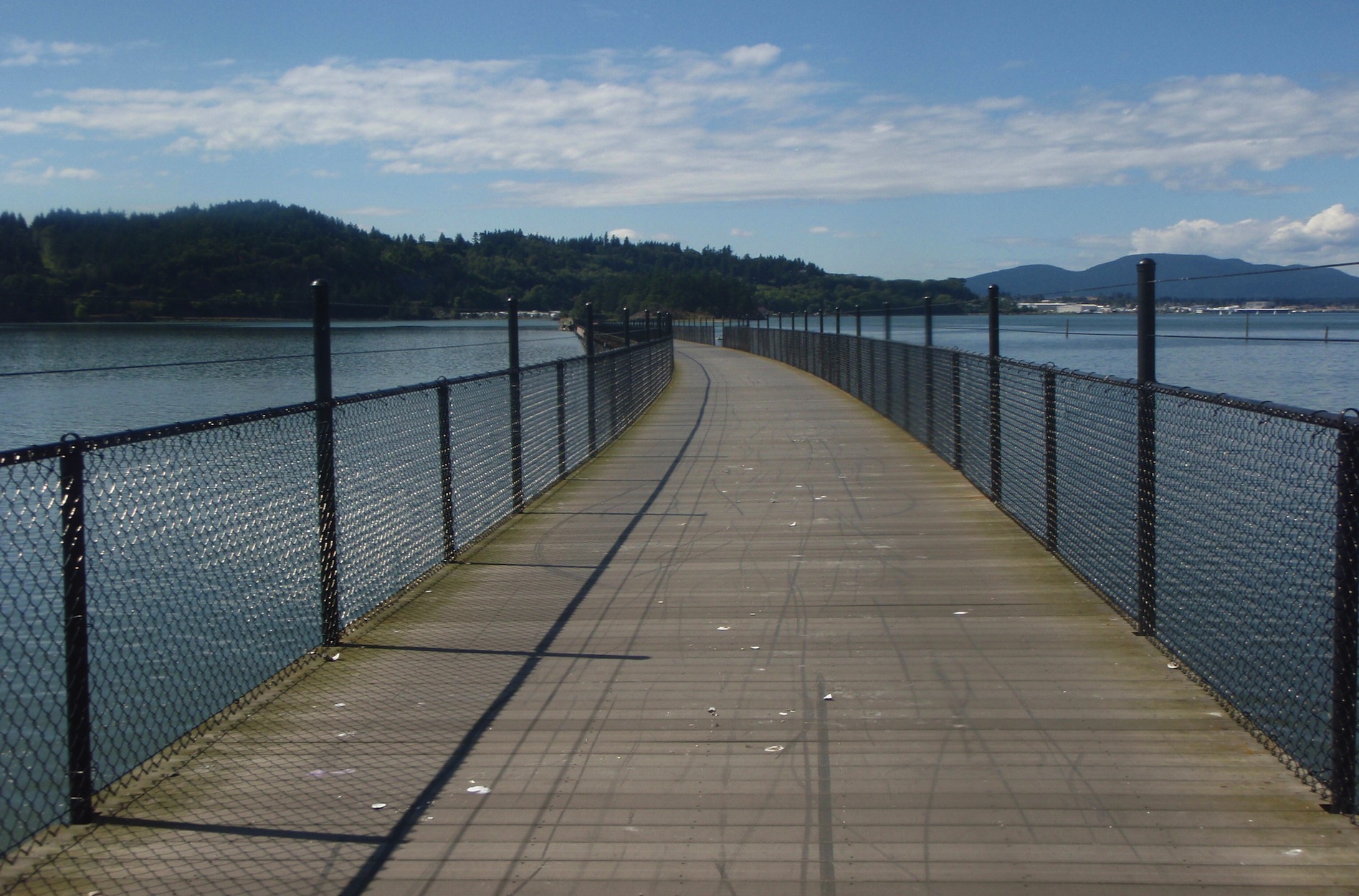
Whidbey Wanderer 600 Pre-ride and Route Info Garmin Connect: http://connect.garmin.com/activity/361417800 So after some e-mail discussions around who would be pre-riding the Whidbey Wanderer 600km and on what date, the number of riders dwindled to just me. The benefit of that was getting to pick my own ride date, which ended up being Aug 17 so as not to use up any vacation time. I tried to reserve a motel room in advance in Burlington, around the 400km mark, but struck out as all the motels were fully booked. I was able to book a room at the Auld Holland Inn in Oak Harbor (the suggested sleep stop at approx 350km) although this was situated a little earlier than I expected to want to sleep. Barb and the kids were good enough to get up early Saturday to drive me to Calhoun's for the ride start. I found the first stretch a little slow-going, partly because it is all uphill for a while, and partly because there were quite a few turns headed along Vancouver bike routes that I don't normally ride. I documented a short detour on River Dr in Richmond that I knew about already, having encountered it when riding in the opposite direction last week on the Escape Velocity Cycling Club Saturday ride. As I continued through Richmond and Surrey, I was wishing the route sheet was more like some of the Southern Interior 600km routes, where all the instructions fit on one piece of paper in a large font. It's always a pleasure to ride past the long lineup of traffic waiting to cross the border and check in at the pedestrian crossing, where there is rarely more than a couple minute wait. After crossing the border, the detailed route instructions took me past Birch Bay, the Cherry Point Refinery, and along Rainbow Rd (a street name which Ryan C. and my kids like due to their fondness for Mario Kart) to Bellingham where I stopped for a snack at the famous Rocket Donuts. Back on the road again, I soon discovered construction on N. State St with traffic down to one lane and a sign saying it would be closed starting Aug 19, and no date for the closure to end listed. Umm... good luck with that next week! Let me know how it goes. It so happens that this past weekend was also the event date for RSVP ("Ride from Seattle to Vancouver and Party"). As I rode south on the Chuckanut, I saw quite a number of event participants riding northbound, towards their sleep stop in Bellingham. They seemed to be having a good time, possibly in part due to the fact that it appears the event organizer had arranged a strong tailwind for them. As I was going in the opposite direction, I was less pleased about this. I continued south to SR 20 West and into Anacortes over a bridge walkway that is maintained by the Skagit Bicycle Club. Every time I have been over this bridge it has been spotless. Watch for the right turn after the bridge for a new route that takes you around March's Point and a close-up view of a couple more refineries. You won't miss the turn on Tommy Thompson Trail as long as you know what you are looking for even though the sign only says "Trail". It is a boardwalk that takes you across Fidalgo Bay into Anacortes. Yes, the route sheet is correct, there are plenty of broken shells along the trail. The route then goes around Anacortes and south through Deception Pass State Park over the bridge to Whidby Island. The "Wandering" on Whidbey Island can be more properly described as a tour of most accessible beach and waterfront locations, where each visit involves riding down a steep hill, admiring the water for a short stretch, and heading back up another steep hill. My Garmin GPS tells me a couple of these hills were in excess of a 20% grade. Except we did skip "Useless Bay" at the south end of the island... not sure why. One note of caution: if you stop riding for any reason near nightfall in certain parts of Whidby Island you will be attacked by hungry mosquitoes. I stopped for two minutes to connect an external battery to my GPS and ended up with at least 10 bites on my legs. Due to headwinds as I was southbound during the day, and spending a lot of time riding uphill, I was going slower than I had originally anticipated. I rolled into Oak Harbour, and found my welcoming hotel room, shortly before 1:00am. At this point I was thankful that I was not successful in booking a room 50km later in Burlington. The route on day two seemed to be a little more direct, and even benefitted from the occasional tailwind, heading along some more familiar road through Mt Vernon, Burlington, and Sedro-Woolley. Heading up Hwy 9, there is one diversion from the usual route to go the long way around Lake Whatcom, and to take in a few more hills before returning to SR 542 and SR9 and across the border back into Canada at Sumas. The route follows more familiar roads through the Fraser Valley, over the Golden Ears Bridge, and along much of my usual commute to work. There is one more construction detour on the Frances-Union Bike route approaching Willingdon where the road is closed for sewer reconstruction. I made good time in the last 50km, as I often seem to do near the end of a brevet when I know I am almost finished. This route will take you longer than you expect, due to plenty of navigation and quite a bit of climbing (all those short climbs really add up), but the scenery and visiting a few new locations makes it all worthwhile. *** Bonus Link: Photo of "Bridge Walkway Maintained by Skagit Bicycle Club Sign": http://flic.kr/p/6ngE1t (taken during 2009 Fleche)
Go to: Whidbey Wandere Route and Info Page
August 20, 2013 |