| Newsletter - 2011 Archive |
|
Cycling Club |
 |
| Newsletter - 2011 Archive |
|
Cycling Club |
|
Next--->
|
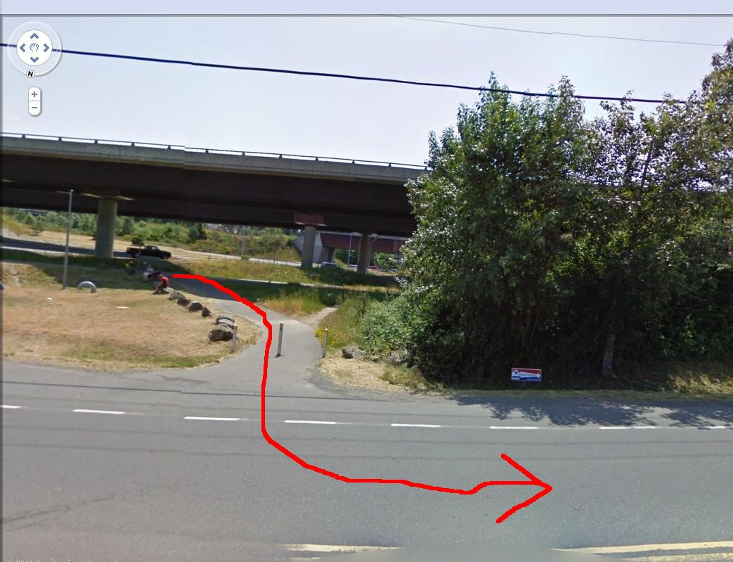
Highway to Hell 400 - Pathfinding Start time 3am @ new start location - 829 Tulip Ave "jims house"...looks like rain so bring your wet weather gear, and good lights! Last night, Philip and I checked out the route out off and into Victoria. This part is worth mentioning as it requires that you follow the Bike Route for Hwy 1. So watch for the signs as they are there but are small. If you find yourself just sailing down the Hwy away from or/toward Victoria, you have likely missed the route. From the start, as you head out of Victoria on Hwy #1, you make a turn at HELMCKEN taking the off ramp (Exit 8) and then back on to the Hwy with the on ramp. But your next turn comes fast and you take the off ramp to Colwood (Exit 10). Now watch for the Bike Route sign as it takes you off the Colwood road, crosses the GG trail then onto Watkiss (not signed).
Its a short uphill section to the next turn. This one is not signed, but its a bike trail through two concrete dividers at a Bus stop shelter.
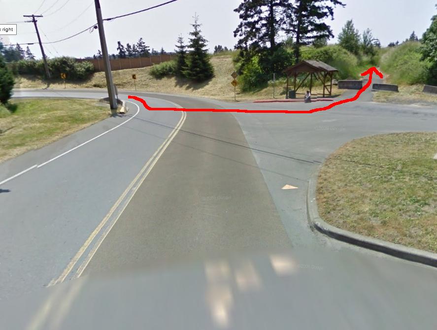
You now pop out on Hwy 1 again.
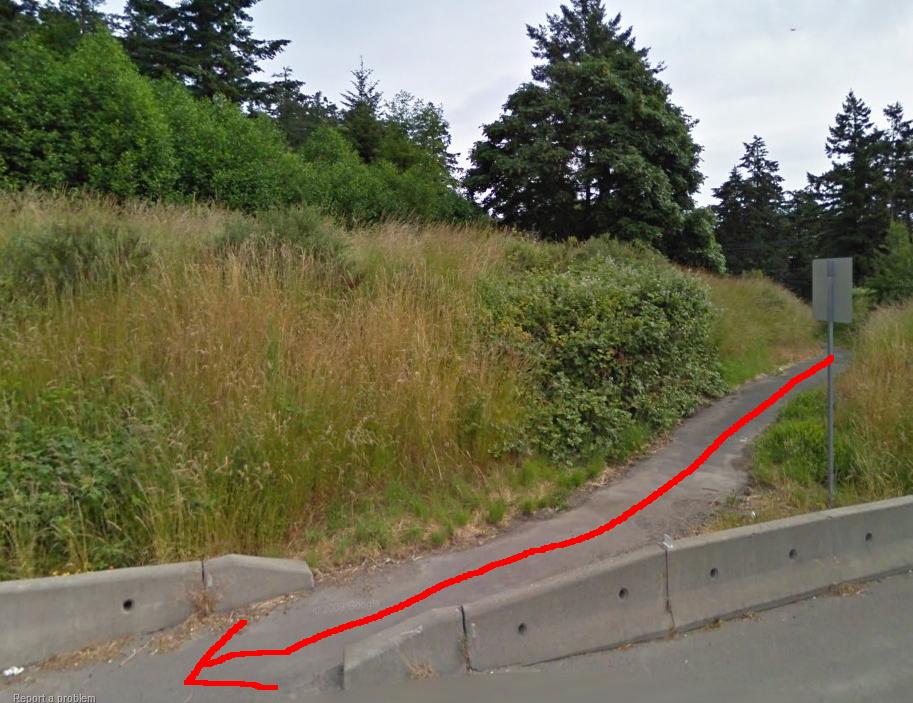
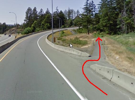
Heading up the Hwy look for Exit 14, and take the Langford turn. Again the bike route turns off this road onto a bike trail, and through a little under pass.
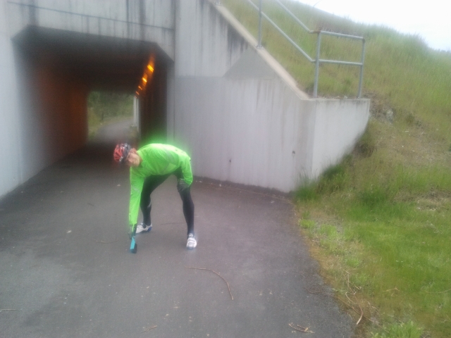
This area is usually peppered with broken glass and so being a caring ride organizer, I took a small hand broom and actually swept much of the glass out of the centre track.
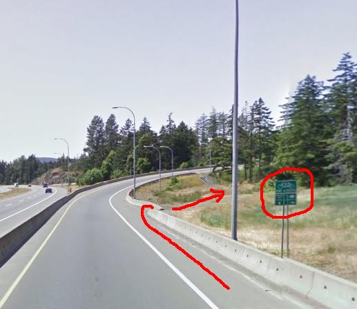
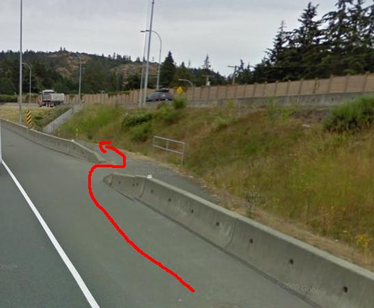
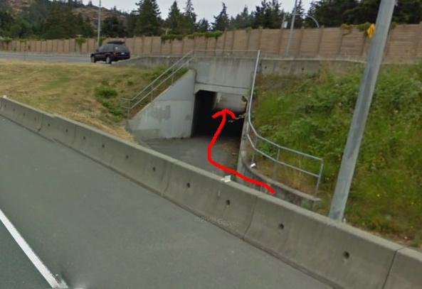
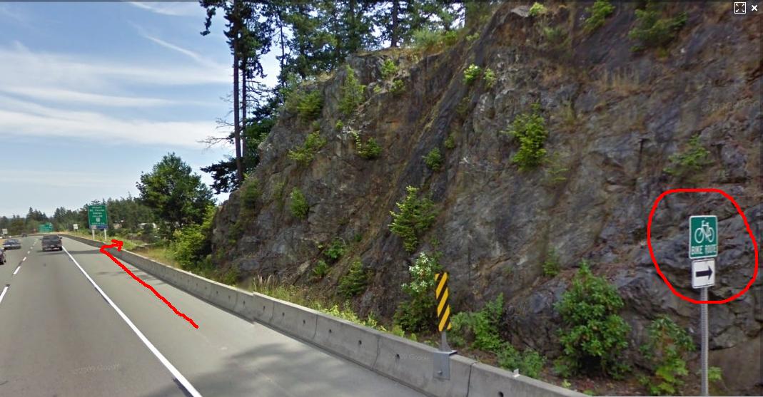
Once you pass through the underpass, its on to the Highway with the Malahat coming next. Last week, Philip road the Malahat to Duncan and reported that the shoulders were clear of much of the gravel and sand that was present during the Hills 300. The rest of the route is in great shape all the way to Union Bay. All the roads were ridden by myself during Hell Week and nothing stands out. Watch the RR track crossing between Qualicum and Union Bay. In Union Bay, the Control is the Market. Last year they had great food, so take advantage of this spot, almost exactly the 1/2 way point. Remember in Buckley Bay, a few kms before Union Bay is a Subway too.A note on Nanaimo: The roads are busy and at points there are no shoulders to ride. Big pick-ups seem to be everywhere, so please be careful as you navigate through this town both going and coming back. The control on the return leg is now at the Tims in South Nanaimo. The route through Shawnigan Lake is nice but the road quality is very poor, so watch for many potholes and broken pavement at the roads edge. Both going and coming, watch for the RUMBLE STRIPS on the Malahat when going down. Finally back in Victoria, you have to deal with two Bike Lane routes. The first is a turn just after the Millstream overpass. It takes you off the Hwy, through an underpass.
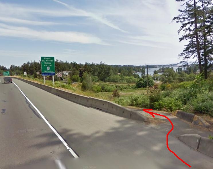
Make a tight left turn and enter the on ramp back to the Hwy. The final Bike Path is tricky so watch for this one. You are going down hill when the sign appears and there is break in the concrete barrier beside the HWY.
There is a NO BIKE sign on the Hwy just past this turn. Once on the bike path it joins a road and comes to a T. Turn L, onto another bike path that joins the GG. Signs point you to a pedestrian light and you cross HWY 14 to the Hwy 1 on ramp. Now just follow the last few turns on the route sheet and you are DONE.
- May 13, 2011 |