Route
The route for the 2016 Rocky Mountain 1200 will be very similar to previous editions, but will be run in the reverse, counter-clockwise direction.
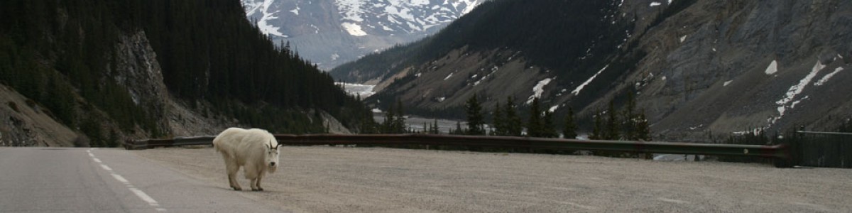
Participants should be aware that there are several sections of the route that utilize highways with heavy motor traffic. In our opinion it is worth enduring these stretches, which are the only options for getting to the more rewarding riding in the national parks.
Ride With GPS map (route map updated June 8, 2016)
2016 Rocky Mountain 1200 route
Download in excel format here
Dist. (cum.) |
Turn |
Dir. |
Route Description |
Dist. (int.) |
Dist. (int.) |
| 0.0 |
START – Kamloops Curling Club700 Victoria StOpen: Mon. 05:00, Close: Mon. 06:00 |
Go | Leg | ||
| 0.0 | L | E | Victoria St | 0.9 | 0.0 |
| 0.9 | BL | E | becomes Battle St | 0.5 | 0.9 |
| 1.4 | L | E | Battle Street @ Columbia | 0.6 | 1.4 |
| 2.0 | BR | SE/E | Highway #1 East (Around cloverleaf. Sign for Banff) | 8.6 | 2.0 |
| 10.6 | R | S/E | Dallas Dr | 0.2 | 10.6 |
| 10.8 | CO | E | 2nd Exit off roundabout stay on Dallas Dr | 0.5 | 10.8 |
| 11.3 | R | S | Barnhartvale Rd | 10.0 | 11.3 |
| 21.3 | CO | E | Caution! Cattleguard. Walk across | 4.0 | 21.3 |
| 25.3 | CO | E | Caution! Cattleguard. Walk across | 11.9 | 25.3 |
| 37.2 | CO | E | Caution! Cattleguard. Walk across | 0.0 | 37.2 |
| 37.2 | CO | E | Caution! RR X | 0.4 | 37.2 |
| 37.6 | R | S | Highway #97 | 12.6 | 37.6 |
| 50.2 | CO | S/E | Caution! RR X | 18.6 | 50.2 |
| 68.8 | CO | E | Caution! RR X | 3.6 | 68.8 |
| 72.4 | CO | E/S | Falkland PetroCan Store on left. Opens at 07:00 | 24.1 | 72.4 |
| 96.5 | CO | S | Do NOT take St Annes Rd on left | 5.6 | 96.5 |
| 102.1 | L | N | St Annes Rd opposite golf course (toilets) | 0.3 | 102.1 |
| 102.4 |
CONTROL #1 – SpallumcheenRoadside (on right) Open:Mon. 08:00, Close: Mon. 11:49 |
102.4 | |||
| 102.4 | CO | N | St Annes Rd | 0.8 | 0.0 |
| 103.2 | R | E/N | Otter Lake Rd | 2.2 | 0.8 |
| 105.4 | R | E/N | Larkin X Rd | 4.5 | 3.0 |
| 109.9 | CO | E | 2nd Exit off roundabout onto E Frontage Rd (underpass) | 0.2 | 7.5 |
| 110.1 | CO | N | 3rd Exit off roundabout for Highway #97A North | 6.6 | 7.7 |
| 116.7 | CO | N | Highway 97A. Armstrong. Services on left for next 2km Caution! Large holes on shoulder next 10 km |
14.9 | 14.3 |
| 131.6 | R | E | Hubert Ave, Enderby (back of IGA marketplace on left after turn) | 0.1 | 29.2 |
| 131.7 | L | N | Vernon St | 0.2 | 29.3 |
| 131.9 | R | E | Cliff Ave (over bridge) | 0.4 | 29.5 |
| 132.3 | L | NE | Enderby Grindrod Rd (Sign for cemetery) | 9.2 | 29.9 |
| 141.5 | BR | N | Highway #97A | 28.1 | 39.1 |
| 169.6 | R | E | Highway #1 (Sicamous. Services next 1.9km) Subway sandwiches on right. Tim Horton’s, Husky on left. |
16.6 | 67.2 |
| 186.2 | CO | E | Malakwa Store on left | 34.8 | 83.8 |
| 221.0 | CO | E | 3 Valley Gap Store on left | 18.8 | 118.6 |
| 239.8 | CO | E | Stay on Highway #1, cross bridge into Revelstoke. Do NOT exit into Revelstoke City Centre. Services for next 700m on Highway. (Bike shop in city centre) |
0.5 | 137.4 |
240.3 |
CONTROL #2 – Revelstoke – Not staffedAsk any business to sign your card + put the timeOpen:Mon. 12:09, Close: Mon. 20:59 |
137.9 | |||
| 240.3 | CO | E | Highway #1 (NO more services til snack stop. 72km) | 47.7 | 0.0 |
| 288.0 | CO | E | Highway #1 – Caution! – 3 Tunnels in next 2 km – Use Lights! | 21.2 | 47.7 |
| 309.2 | CO | E |
Rogers Pass (1330m)Convenience Store – CLOSEDCafeteria – CLOSEDStaffed Snack Stop (on right. Personal Support OK)
|
2.5 | 68.9 |
| 311.7 | CO | E | Highway #1- Caution! – 5 Tunnels in next 3 km – Use Lights! Careful! Steep descent for next 10 km | 17.3 | 71.4 |
| 329.0 | CO | E | CAUTION! Road construction for several kilometres. Shoulder higher than road. No painted lines. Sharp drop off. | 58.9 | 88.7 |
| 387.9 | R | SW | Take exit Right for Highway #95, Radium Hot Springs | 0.4 | 147.6 |
| 388.3 | CO | SW | Highway #95 across bridge over railway and around cloverleaf | 0.3 | 148.0 |
| 388.6 | BR | SE | Highway #95 (10th Avenue N) | 1.0 | 148.3 |
| 389.6 | BL | E | Highway #95, after bridge becomes 10th Avenue S | 0.1 | 149.3 |
| 389.7 | BR | S | Highway #95 (10th Avenue S) | 0.2 | 149.4 |
| 389.9 | L | E | 9th Street S | 0.6 | 149.6 |
| 390.5 |
CONTROL #3 – GoldenMount 7 Rec Plex (on right)
|
150.2 | |||
| 390.5 | T | W | 9th Street S | 0.6 | 0.0 |
| 391.1 | R | N | 10th Avenue S (Highway #95), across bridge | 1.2 | 0.6 |
| 392.3 | CO | NW | Under overpass | 0.2 | 1.8 |
| 392.5 | L | SW/NE | Around cloverleaf. Signs for Lake Louise, Banff | 0.7 | 2.0 |
| 393.2 | R | E | Just past Station Ave, Just before Highway #1, take Bike Route parallel to highway (NO services for 80km) |
1.5 | 2.7 |
| 394.7 | R | E | Golden View Rd | 0.2 | 4.2 |
| 394.9 | L | N | ramp to Highway #1 Caution! Cattleguard. Walk across |
0.1 | 4.4 |
| 395.0 | R | E | Highway #1 – Caution! Narrow shoulders & steep winding road next 10 km | 53.2 | 4.5 |
| 448.2 | CO | E | Highway #1, Field Store (Tea House & Gifts) – has drinks + snacks Open – 08:00 – 20:00 MDT |
16.3 | 57.7 |
| 464.5 | CO | E | Kicking Horse Pass (1658m) | 8.9 | 74.0 |
| 473.4 | BR | S | Exit toward Lake Louise (Bow Valley Parkway) | 0.4 | 82.9 |
| 473.8 | R | W | Lake Louise Drive – Caution! BAD Cattleguard / Texas Gate. Walk across | 0.2 | 83.3 |
| 474.0 | L | S | Village Road (at 4-way Stop) | 0.4 | 83.5 |
| 474.4 |
CONTROL #4 – Lake LouiseRecreation Centre (at end of road on right)
|
83.9 | |||
| 474.4 | T | NW | Village Road | 0.4 | 0.0 |
| 474.8 | R | E | Lake Louise Drive (at 4-way Stop) – Caution! BAD Cattleguard / Texas Gate. Walk across | 0.4 | 0.4 |
| 475.2 | L | NW | Highway #1 on-ramp. NO services for 79km | 2.5 | 0.8 |
| 477.7 | BR | NW | Exit to Highway #93 toward Jasper & Rocky Mountain House | 0.3 | 3.3 |
| 478.0 | CO | NW | Highway #93 Caution! BAD Cattleguard / Texas Gate. Walk across |
0.1 | 3.6 |
| 478.1 | CO | NW | Highway #93 – Park Gate | 39.7 | 3.7 |
| 517.8 | CO | NW | Bow Summit (2065m) | 36.2 | 43.4 |
| 554.0 | CO | NW | Highway #93 The Crossing (Personal Support OK) Services Open: Store – 07:00 – 22:00 MDT Cafeteria – 09:00 – 17:00 MDT Restaurant- 07:00 – 10:30, 17:00 – 22:00 MDT Pub – 07:00 – 23:00 MDT Motel |
30.4 | 79.6 |
| 584.4 | CO | NW | Sunwapta Climb Begins | 14.3 | 110.0 |
| 598.7 | CO | NW | Sunwapta Pass (2035m) | 4.5 | 124.3 |
| 603.2 | CO | NW | Highway #93 – Columbia Icefields Centre (Access via Upper Bus Parking Lot Entrance) Services Open: Cafeteria – 08:30 – 18:00 MDT Dining Room – 08:00 – 10:00, 12:00 – 14:30, 18:00 – 21:00 MDT |
17.5 | 128.8 |
| 620.7 |
CONTROL #5 – Beauty Creek Hostel Parking Lot(on left side of road)
|
146.3 | |||
| 620.7 | CO | NW | Highway #93 | 31.3 | 0.0 |
| 652.0 | CO | NW | Highway #93 – Sunwapta Falls Lodge & Restaurant Open – 11:00 to 17:30 MDT | 53.3 | 31.3 |
| 705.3 | CO | N | becomes Connaught Dr – into Jasper Townsite (cross Highway #16 at traffic light) |
1.8 | 84.6 |
| 707.1 | L | W | Miette Ave (at end of train station) | 0.4 | 86.4 |
| 707.5 | L | S | Turrett St | 0.1 | 86.8 |
| 707.6 |
CONTROL #6 – JasperMcCready Centre (on left)
|
86.9 | |||
| 707.6 | T | N | Turrett St | 0.1 | 0.0 |
| 707.7 | R | E | Miette Ave | 0.3 | 0.1 |
| 708.0 | R | S | Connaught Dr | 1.7 | 0.4 |
| 709.7 | R | W | Highway #16 (Yellowhead Highway) At night, NO services until Valemount – 123 km |
63.4 | 2.1 |
| 773.1 | CO | W | Highway #16 – Water coming from pipe Approaching west end of Moose Lake Warning sign but locals take water here |
21.5 | 65.5 |
| 794.6 | CO | W | Highway #16 – Mt. Robson Store and Cafe Store – Open 07:00 – 20:00 Café – Open 08:00 – 17:00 Water tap on west side of store available 24hr |
16.3 | 87.0 |
| 810.9 | BL | S | Highway #5 (sign for Valemount and Kamloops) | 19.4 | 103.3 |
| 830.3 | L | E | 5th Ave, Valemount (opposite Pine Rd) | 1.6 | 122.7 |
| 831.9 | L | NW | Main St (Whiskey Fill Rd) | 0.7 | 124.3 |
| 832.6 |
CONTROL #7 – ValemountLions Hall (on right)
|
125.0 | |||
| 832.6 | T | SE | Main St (Whiskey Fill Rd) | 0.7 | 0.0 |
| 833.3 | R | W | 5th Ave | 1.6 | 0.7 |
| 834.9 | L | S | Highway #5 (NO services until Blue River – 90 km) | 89.5 | 2.3 |
| 924.4 | L | E | Angus Horne St (across from PetroCan) | 0.1 | 91.8 |
| 924.5 | R | S | Cedar St | 0.2 | 91.9 |
| 924.7 | L | E | 3rd Ave | 0.4 | 92.1 |
| 925.1 | L | N | Pine St | 0.1 | 92.5 |
| 925.2 |
CONTROL #8 – Blue RiverLegion Hall (on left)
|
92.6 | |||
| 925.2 | T | S | Pine St | 0.1 | 0.0 |
| 925.3 | R | W | 3rd Ave | 0.4 | 0.1 |
| 925.7 | R | N | Cedar St | 0.2 | 0.5 |
| 925.9 | L | W | Angus Horne St | 0.1 | 0.7 |
| 926.0 | L | S | Highway #5 | 0.4 | 0.8 |
| 926.4 | CO | S | Highway #5 Sandman Inn Restaurant Open 06:00 – 22:00 |
0.2 | 1.2 |
| 926.6 | CO | S | Highway #5 Husky Store 24 hr Husky Restaurant Open 07:00 – 13:00 |
20.3 | 1.4 |
| 946.9 | CO | S | Highway #5 – Messiter Summit (765m) Caution! No painted lines for ~20 km |
18.4 | 21.7 |
| 965.3 | CO | S/W | Highway #5 Avola Gas and Store Open 08:00 – 22:00 |
67.0 | 40.1 |
| 1032.3 | CO | S | 3rd Exit off roundabout onto Park Dr | 0.2 | 107.1 |
| 1032.5 | L | E | Murtle Cr | 0.1 | 107.3 |
1032.6 |
CONTROL #9 – ClearwaterSportsPlex (on right) Open:Tue. 15:20, Close: Thu. 08:56 |
107.4 | |||
| 1032.6 | T | W | Murtle Cr | 0.1 | 0.0 |
| 1032.7 | R | N | Park Dr | 0.2 | 0.1 |
| 1032.9 | CO | N | 2nd Exit off roundabout onto Clearwater Valley Rd Rough road and narrow shoulder for first 5 km |
25.1 | 0.3 |
1058.0 |
CONTROL #10 – Wells GrayU C F I Hall and Grounds (on right)
|
25.4 | |||
| 1058.0 | T | S | Clearwater Valley Rd | 20.1 | 0.0 |
| 1078.1 | CO | S | Clearwater Valley Rd Caution! Rough road and narrow shoulder on winding descent |
5.0 | 20.1 |
| 1083.1 | CO | W/S | 1st Exit off roundabout onto Highway #5 | 1.0 | 25.1 |
| 1084.1 | BR | W | Old North Thompson Highway Rd E | 8.3 | 26.1 |
| 1092.4 | R | S | Highway #5 | 22.2 | 34.4 |
| 1114.6 | CO | S | Highway #5 Little Fort Husky Store Open 07:00 – 22:00 Subway Open 07:00 – 21:45 |
31.4 | 56.6 |
| 1146.0 | CO | S | Highway #5 Barriere Esso Convenience Store – Open 24hr |
56.4 | 88.0 |
| 1202.4 | CO | S | Do NOT take Halston Ave / Paul Lake Rd (1st Traffic Light) | 1.7 | 144.4 |
| 1204.1 | R | SW/S | Mt Paul Way, Kamloops (2nd traffic light) | 1.4 | 146.1 |
| 1205.5 | CO | S | Caution! Take lane to cross narrow Red Bridge (Avoid wood sidewalk) |
0.4 | 147.5 |
| 1205.9 | L | E | Lorne St | 0.3 | 147.9 |
| 1206.2 | CO | E | Caution! RR X (tracks on BAD angle) | 0.4 | 148.2 |
| 1206.6 | R | S | 10th Ave (River St) through underpass | 0.1 | 148.6 |
| 1206.7 | R | W | Victoria St | 0.3 | 148.7 |
| 1207.0 | BL | W | Victoria Street (left lane) | 0.3 | 149.0 |
| 1207.3 |
FINISH CONTROL – KamloopsCurling Club (on right)
|
149.3 | |||
| NOTE: All times given in PDT unless indicated with MDT | |||||