25 km ride leaves after the 50, at ~9:05 a.m.
(Updated March 31, 2023)
RwGPS route:
https://ridewithgps.com/routes/38906676
| Home |
|
|
|
|
|
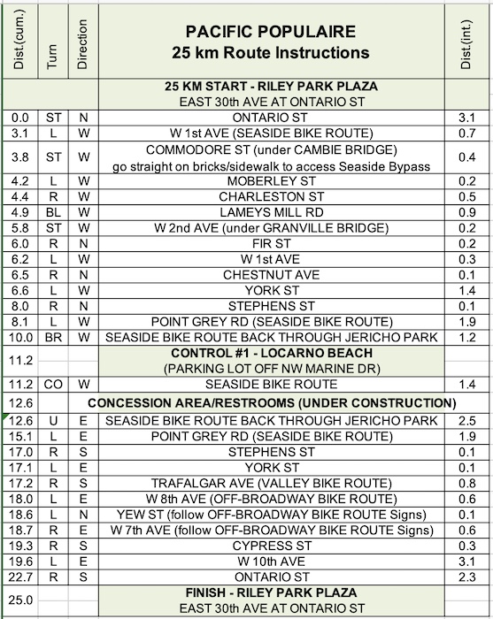
2023 Pacific Populaire
25 km Route Instructions
25 km ride leaves after the 50, at ~9:05 a.m.
(Updated March 31, 2023)
RwGPS route:
https://ridewithgps.com/routes/38906676
L=Turn Left
R=Turn Right
CO=Continue On
ST=Straight
T=Turn Around